Why Professional Photography Is the First Step to Selling Your Commercial Property in Queens or Long Island
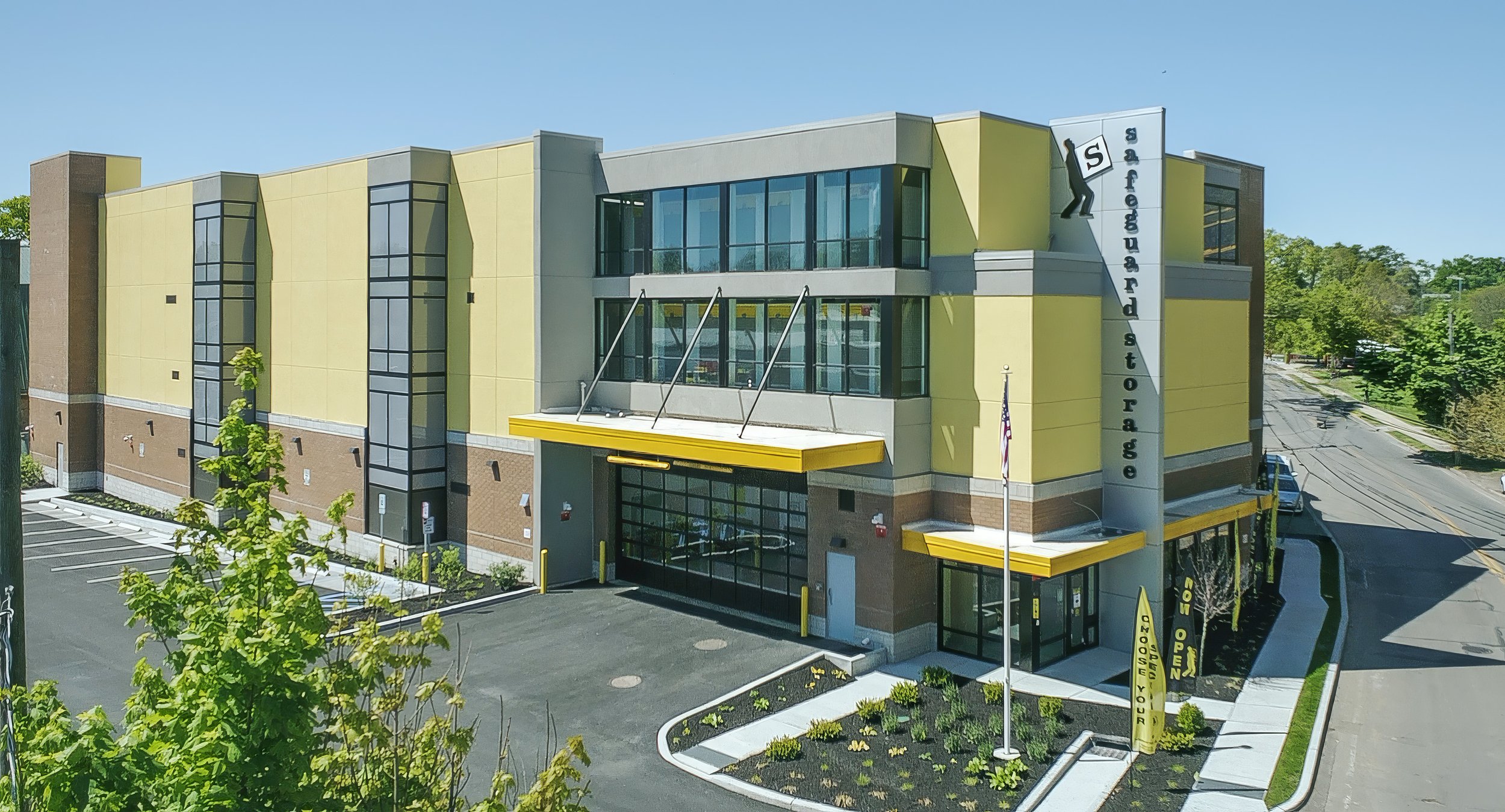
Photo Taken By Ariel Palma
When you put a commercial property on the market in Queens or Long Island, the first showing doesn't happen in person. It happens online — on a screen, in a few seconds — before any buyer has returned a call or driven the property.
In that moment, your photography is doing all the talking.
The commercial real estate market in the New York metro area is competitive at every price point. A retail storefront in Nassau County, an office building in Flushing, a multi-unit investment property along Northern Boulevard — these assets are competing for the attention of buyers who are reviewing multiple opportunities at once. The difference between a listing that generates immediate inquiries and one that sits on the market often comes down to one thing: the quality of the visual presentation.
At The Right Bob Realty, professional photography and drone documentation are standard parts of how we bring commercial listings to market — because we've seen firsthand what strong visuals do for a sale.
What Buyers Are Actually Doing Online
Before a commercial buyer schedules a tour or calls a broker, they've already formed an opinion based on what they saw on CoStar, LoopNet, or the listing website. Research consistently shows that listings with professional photography receive up to 61% more online views than those with amateur images, and properties with high-quality photos sell up to 32% faster than comparable listings without them.
For a commercial seller, that speed difference translates directly to carrying costs — debt service, taxes, insurance, and maintenance — that continue every week the property sits unsold. If professional photography shortens your marketing period by even two to three weeks, the value recovered far exceeds the cost of doing it right.
Price is affected too. Studies show professionally photographed properties consistently sell for more than comparable listings with standard imagery, in some cases significantly more per square foot. In a market where buyers are underwriting deals based on price per square foot, that premium is real money.
What Poor Listing Photos Actually Cost You
Browse any commercial listing database and the pattern is clear: even properties priced in the millions are often represented by a handful of flat, poorly lit images taken from a parking lot, with no aerial perspective and no sense of the asset's context or condition.
For a buyer evaluating a property remotely, those images answer almost nothing. They don't show site access, parking capacity, street visibility, signage placement, or how the building sits within its trade area. These are the exact questions a commercial buyer is trying to answer early in the process. When the photography doesn't provide those answers, buyers either make an unnecessary site visit — or they move on to the next listing.
Poor photography doesn't just slow down a sale. It can quietly suppress the final price by failing to communicate the property's real value to buyers who never get far enough into the process to understand what they're looking at.
The Role of Aerial Photography in Commercial Listings
For commercial properties in Queens and Long Island, drone photography isn't a luxury — it's one of the most practical tools in the marketing package.
A ground-level photo of a commercial building shows the facade. A drone photo shows everything a buyer actually needs to understand a location: the full site footprint, parking layout, access from adjacent roads, proximity to major corridors and transit, surrounding uses, and the property's visibility within its immediate market. According to industry research, aerial photography alone accelerates commercial sale timelines by as much as 68%.
Queens is particularly well-suited to aerial documentation. The borough's density means that site context — what's adjacent, what's accessible, how the property relates to the street grid — is often the most compelling part of the value story. A single aerial photograph can communicate what paragraphs of listing copy cannot.
On Long Island, aerial coverage helps buyers understand the regional positioning of an asset: proximity to the LIE, the Northern or Southern State, major retail corridors, or transit nodes. That context is invisible from the ground and immediately clear from above.
All drone operations for our listings are conducted with FAA Part 107 certification and proper airspace authorizations. In New York City's controlled airspace, this isn't optional — it's a compliance requirement that protects both the photographer and the property owner.
Ground Photography: The Details That Convert
While aerial imagery establishes context and location, ground-level photography is what converts serious interest into action.
A well-executed ground shoot covers the facade from multiple angles at the right time of day — when directional light reveals the building's materials, depth, and architectural detail rather than flattening it into a wall of glare. It captures the entrance, the signage as it reads from the street, the condition of the exterior, and the quality of the landscaping and site improvements. For commercial assets with interior space that factors into the buyer's underwriting — retail, office, mixed-use — interior coverage documents finish quality, layout, and occupancy condition.
Taken together, ground and aerial photography create a complete visual picture of the property. Not just what it looks like, but where it is, how it functions, and why it's worth what it's worth.
How We Bring Your Commercial Listing to Market
At The Right Bob Realty, we understand that selling a commercial property in Queens or Long Island is not the same as listing a home. The buyer pool is different, the due diligence process is different, and the marketing package needs to reflect that.
We coordinate professional photography and aerial drone documentation as part of our standard listing process, alongside placement on OneKey MLS, CoStar, LoopNet, and our own platform, targeted digital marketing to qualified commercial buyers, and the personal, responsive service that has helped us close more than $50 million in real estate across the communities we serve.
If you're considering selling a commercial property in Queens or Long Island — or you want to understand what your asset is worth in today's market — we're ready to have that conversation.
Sources
90+ Key Real Estate Photography Statistics & Trends | PhotoUp
How Drone Photography Elevates Real Estate Listings in NYC | RealtaSnap
Bad Listing Photos Can Cost You Thousands | The Real Estate Pros
Thinking about selling a commercial property in Queens or Long Island?
Contact The Right Bob Realty today for a no-obligation property evaluation and to learn how our full-service marketing approach — including professional photography, aerial drone documentation, and targeted buyer outreach — can help you sell faster and for more.
theRightBob.com | 516-500-2872 | info@rightbob.com